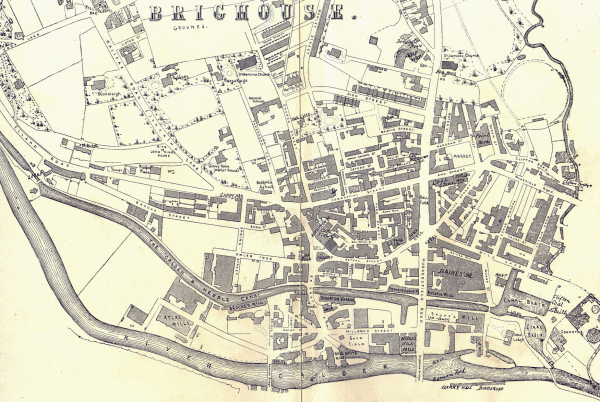
This map is dated c1893 and shows the whole of the town centre as it then was. Looking at it closely you can see there have been many changes over the last 131 years. One interesting feature are the number of backyards between and behind buildings. Many of these did have names but have now long been forgotten. For example the yard behind M & S Locks in Bradford Road is officially known as Barton'a Buildings, which is possiby named after the local nineteenth century builder John Barton. Walking through the alley way on Commercial Streret to get to the bus station, as you walk through you will pass Ball's Yard, look closely and you will see the sign telling you that. There are many more see if you can find them.


